Edinburgh, with its generally dense population and walkable distances, could be a European exemplar of a pedestrian-friendly city. But the many sensible walking-related policies of the City of Edinburgh Council too often don’t translate in practice into a safe and attractive walking environment on the streets. Motor traffic continues to dominate the vast majority of the city’s streets – yet there are clear economic, environmental and social benefits in prioritising pedestrian movement within a high-quality public realm.
Our overall aim is to:
Promote walking (including ‘wheeling’) as a safe, enjoyable, accessible and healthy way of getting around Edinburgh.
To this end, we want to see:
walking given the top priority over other forms of travel in all council transport and planning policies;
a reduction in the volume of motorised traffic and its impact on people using the street;
better designed and maintained pavements, road crossings and other pedestrian facilities;
more effective and joined-up monitoring and inspection of the walking environment by CEC;
planning policy which encourages dense, sustainable housing over car-dominated, dispersed development;
more effective implementation of pro-walking policies ‘on the ground’.
Our priorities for action in 2026 are to:
Campaign for increased budgets (capital and staffing) for the pedestrian environment by the City of Edinburgh Council, especially to:
widen footways;
tackle pavement clutter;
improve priority for pedestrians at signalled crossings;
improve accessibility by installing dropped kerbs and continuous footways.
Secure better enforcement of controls on parking (including new ‘pavement parking’ provisions) and speeding.
Support specific local campaigns for place-making and traffic reduction.
Develop our work on walk-friendly environments at and around schools.
Influence planning policy and practice to aid walking and wheeling and reduce motor traffic.
Influence Holyrood 2026 to support our four election asks (engine idling, zebra crossings, roadworks and speed cameras: https://bit.ly/4o5nTVd )
Grow the number of our supporters and range of our campaigns.
Thank you for your request for information of 03/04/2026 which has been processed and considered under the Environmental Information (Scotland) Regulations 2004 (EIRs). The information is provided below.
With regards to Trade Waste, please provide the following information for each of the three years 2023/24, 2024/25 and 2025/26:
How many penalty notices were issued for contravention of Right Time, Right Place policies?
What was the total of penalties issued?
What was the total of ££ collected (i.e. paid)?
No. of FPNs issued
FPN Overall Total
FPN payment Received
2023/2024
123
£9840
£6080
2024/2025 *
123
£29800
£16200
2025/2026
66
£33,000
£20,000
* The FPN amount was increased by the Scottish Government from £200 to £500 and implemented from November 2024.
It is often difficult to understand the most significant features of proposals like this from visualisations and drawings. From looking at the plans and from correspondence with council officers, we understand that key features are:
a continuous two-way cycleway from Prestonfield Avenue to Fort Kinnaird;
space for the cycleway on Peffermill Road to be taken from what is currently the carriageway;
space for the cycleway on Niddrie Mill Road Road to be taken from what is currently the northern footway;
the southern footway along the route will be largely unchanged;
a number of bus stops to be merged and all to have cycle bypasses (floating bus stops);
new bus lanes eastbound approaching the junction with Duddingston Road West and westward, for example from Hay Drive;
junction treatments to be altered to favour pedestrian movement (corner ‘tightening’, continuous footways, etc) and more significant re-design to reduce motor traffic priority at key junctions like Greendykes Road and Craigmillar Castle Road;
public realm improvements and new paths, for example at Cairntows Park, Castleview school etc.
Overall concept
This project originated as a ’20 minute neighbourhood’ project:
“We want to revitalise the area around Niddrie Mains Road by creating better spaces for recreation and socialising alongside safe, high-quality walking, wheeling, and cycling routes. Our plans also include improving access and amenities around Cairntows Park.”
Responses to the consultation broadly appear to have endorsed the followine objectives:
“When asked about what could improve the experience of spending time on the High Street, most comments were about maintenance, safety, environment, and amenities, such as:
Better care and maintenance of public realm around shopfronts, more bins, and upgraded street furniture.
More greenery, benches, better pavement, and less traffic.
More police presence to deter antisocial behaviour.
More local shops, family friendly cafes, pubs, and better leisure facilities.”
We are therefore disappointed to see little emphasis on many of these issues. What was originally envisaged as a ‘placemaking’ exercise appears to have transformed into an ‘active travel scheme’ on a two mile long travel corridor from Prestonfield Avenue (or Cameron Toll as originally planned) to Kinnaird Park.
We understand that the Council’s 20 Minute Neighbourhood team has been disbanded; the reduced emphasis on ‘place’ is evident in these proposals which appear to prioritise the introduction of a continuous segregated cycleway. An emphasis on place would require not only changes to road design but also economic and social interventions, for example to enhance the commercial viability of local shops, tackle anti-social behaviour, etc.
Pavements
Craigmillar and Niddrie are unusual in that there are several extremely wide footways, as a result of major changes introduced before 2000. Normally, we would object in principle to conversion of pavements to other uses (road, cycleway, etc.) as being contrary to the sustainable travel hierarchy which puts pedestrian movement first. However, we accept that a lot of pavement space in the area is poor quality and in places excessive, adding little to the quality of the area, so consideration of alternative use of some space (e.g. for cycleways or bus lanes) could be justified.
Nevertheless, more new quality space with greenery should be integral to the scheme; as it stands, we understand that sections of the northern High Street pavement will be reduced to narrower than the ‘desirable’ 3 metre standard set out in the Edinburgh Street Design Guidance. Adequate pedestrian space should be the top priority in any scheme prioritising ‘place’ over ‘movement’.
Other comments
We welcome a number of specific features:
the junction treatments at side roads giving step-free access and emphasising pedestrian priority. However, many of these (King’s Haugh, Dunkirk Road, Hay Avenue, Blackchapel Close) do not promote the natural direction of travel for pedestrians and also deviate the cycleway.
the simplifying of the Duddingston Road West junction; we hope that pedestrian phasing of the signals is optimised.
the redevelopment of Cairntows Park, where street trees are proposed along the high street and the Castleview school proposals.
We suggest:
consideration is given to enhancing some of the uncontrolled pedestrian crossings over Niddrie Mill Road in particular by adding zebra crossings.
extending the 20mph speed limit from Niddrie Mains Rd (where it currently ends) all the way to Fort Kinnaird.
We have concerns at:
the closure/merger of several bus stops, which is likely to make it harder for people with limited mobility to use local bus services.
the routine installation of ‘floating’ bus stops; we receive regular feedback that these are a problem for older and disabled people, especially visually impaired. We consider that the description of these stops in the consultation is misleading (“creating a safe place for people to wait for the bus whilst also providing continuous safe cycling.”)
Conclusion
While there are certainly aspects of the proposals which would improve the Craigmillar/Niddrie area and its travel links, we would like to see the Council sponsor fewer big expensively-engineered active travel schemes like this. Instead, there should be greater emphasis on smaller, local schemes especially to enhance pedestrian spaces, neighbourhood shopping centres, schools, health centres, etc. These interventions would benefit more people at reduced public expense.
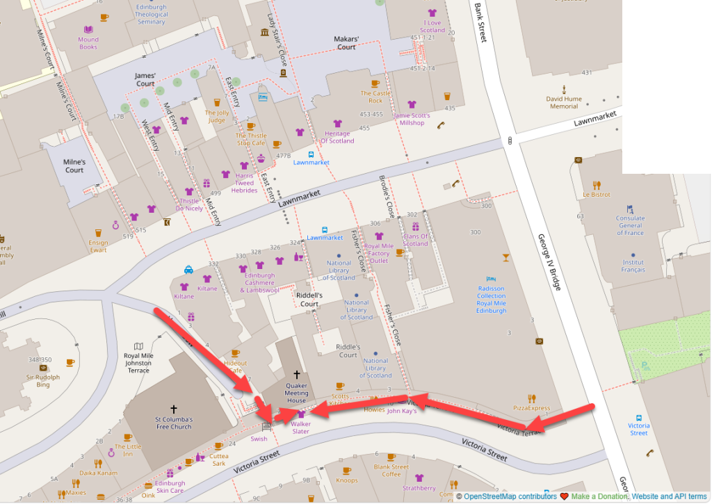
Living Streets Edinburgh Group Public Meeting – 6.00pm, Thursday, 11 June 2026 Friends Meeting House, Victoria Terrace
AGENDA
Introductions / apologies.
Minutes of last AGM, 29 May 2025
Convenor’s report
Treasurer’s report.
“Social Closening”:Presentation by Malcolm Fraser, Fraser Livingstone Architects*
Presentation by Helga Rhein, retired GP, ‘Broomhouse Easy Walkers’
Group discussions – your priorities, and how can we make Edinburgh better for walking?
AOB.
* Malcolm Fraser, an architect, cyclist and pedestrian champion who has fought to renovate buildings (rather than demolish them) and put people and place at the heart of regeneration, will talk about a social Edinburgh of the Past and Future.
Living Streets Edinburgh Group would like to supplement our objection to the TRO with the following brief comments. The key issue is the failure of the Council to give adequate priority to the needs of pedestrians, in conflict with both national and local (Council) policy.
These comments assume that the strategic case for the scheme is essentially sound, with regard to, for example the viability of bus routes, traffic management etc. given that we do not have information which either confirms or counters the assumptions. We are particularly concerned at the failure to improve pavements on the Mound and Hanover Street. In addition we understand that a significant section of high-footfall pavement would be removed on the south of George IV Bridge adjacent to the National Museums of Scotland. Finally, we object to the inappropriate use of ‘floating’ bus stops.
Policy
The Council’s Statement of Case is extremely selective and biased with regard to citing both national and local policy. While the National Transport Strategy, NPF4 etc. are cited widely in support of cycling provision, there is (astonishingly) no mention of the universally agreed ‘sustainable travel hierarchy’ which places walking and wheeling at the top. There are 36 references to “walking” in the Statement, with 68 for “cycling”.
In contrast, little policy is quoted in support of walking and especially the need for accessible pedestrian environments such as for example, the introduction to the Council’s Active Travel Implementation Plan: “We want to work towards a transformational change in walking and wheeling in Edinburgh. Our vision is a fully accessible city, where people of all ages and abilities can get around safely, conveniently and comfortably.”
The numerous references to policy highlighting the importance of “active travel” or “cycling, walking and wheeling” do not adequately recognise the different and at times conflicting, infrastructure requirement of cycling on the one hand, and walking the other. While there are a number of references to the ‘desirable’ widths (according to guidance) of cycleways – 2.5-3.00 metres) there are none to the desirable width of footways (3.00m).
The Mound
The inadequate consideration of walking is clearest with regard to the Mound, where the Council proposes no general footway widening despite acknowledging that it forms part of the “primary network for place…and for walking” (2.16). Pavements are so crowded at times that pedestrians are frequently found to be walking in the road.
Meadows to George St.
Despite claiming that the footways meet an opaque ‘pedestrian comfort’ test, the current Chief Executive of the Council reported in 2020 “pavements being often over-capacity and people having to stray onto the road”.1 Under the present plans this will continue, both in the road on the western pavement, and in the cycleway to the east – disadvantaging all road users.
As noted above, the desirable minimum width for the Mound footways is 3.00 metres according to the ESDG, but in places they would remain less than 2 metres wide (a minimum standard not only for Edinburgh but also national Inclusive Mobility guidance. The Council’s statement in paragraph 8.5 that “it has not been possible to provide additional footway widening on the eastern footway alongside the proposed cycleway” is patently untrue: footways could be widened if the Council was willing to compromise on its preferred design for the cycleway. One obvious example would be to limit the cycleway to 2.5m (still meeting “desired” standards for high volume cycleways) instead of 3.00m. Similar concerns apply to Hanover Street, where some of the city’s busiest pavements will be criss-crossed by cycleways with floating bus stops. While we consider George IV Bridge to be less problematic, we strongly object to the removal of a section of very busy pavement adjacent to the National Museums of Scotland.
Floating Bus Stops
We strongly object to the inclusion of bus stop bypasses on the hilly Mound and Hanover Street. They would build in conflict between pedestrians and cyclists and will deter disabled people from using some of the busiest city centre bus stops. They are unlikely to work well for cyclists either.
The Statement of Case is especially selective in citing standards and guidance in support of the bus stop bypasses, such as ‘Cycling by Design’. However, it omits crucial qualifications such as: “Bus stop bypasses on steep downhill gradients should be avoided, as cycle users are likely to approach these at higher speeds, creating interactions that are more difficult to manage.” (CbD p97).
The Statement refers extensively but again selectively to a report by Living Streets UK in support of cycle bypasses, but omits this important section: “we recommend that those promoting or providing bus stop bypasses should more clearly acknowledge that continuing a cycle track at a bus stop is likely to introduce some disadvantage to blind and partially sighted pedestrians, even if well-designed, and even if the design enhancements described in this report are proven effective. The risks of disadvantage to a wider group of pedestrians and other disabled people should also be acknowledged for complex environments where cycle tracks are busy, if cycling speeds in the location are higher, and in any case where cycling levels are very high.” (P126) 2
Meadows to George St.
The Statement ignores much other authoritative guidance such as “Creating a public realm for all’ (CIHT 2024) and ‘Designing for Inclusion’ (UCL, 2024) which 3 4 all emphasise the problems caused by floating bus stops for pedestrians, especially blind and disabled. We therefore do not consider that the Statement is balanced or objective with regard to bus stop infrastructure, or indeed consistent with the Council’s commitment to accessible public spaces as noted at the start of this document.
Alternative options
We recognise that the connection of cycle facilities from Middle Meadow Walk to the city centre is a legitimate and important objective; however, it must be balanced against other priorities.
Monitoring of movement carried out by the Council 8 years ago showed starkly how many more pedestrians used the streets compared to cyclists (see appended table). This fundamental fact is given insufficient weight in the plans.
The data also appears to show that fewer than half the northbound cyclists using Forrest Road went on to continue along the route though Bank Street, the Mound etc. Many presumably dispersed along Chambers Street, Candlemaker Row, the High Street etc, or their destination was on George IV Bridge itself. This suggests that the rationale of assuming that Meadows to George Street is a primary route may not be justified. We therefore suggest some alternative options to meet the need for improved cycling facilities which would not result in unacceptable compromises to walking and wheeling:
1) no cycleway on the Mound, recognising that the cycling environment will be much enhanced compared to the present owing to the greatly reduced volume of traffic resulting from the bus gate, along with the 20mph speed limit. We are sceptical that many northbound (downhill) cyclists would in any case use the segregated cycleway in preference to the carriageway.
2) a narrower cycleway on the Mound; a 2.5 metre wide cycleway still meets minimum standards, but would allow footways to be widened by 0.5m.
3) a one-way cycleway on the Mound (southbound) – consistent with cycle design standards which emphasise the greater importance of segregation on uphill routes.
4) end the George IV Bridge cycleway at the Royal Mile and provide alternative signed low-traffic routes to the east (via the High Street, Cockburn St, Bridges etc) and west (via Victoria Street, Lawnmarket/Johnston Terrace, etc).
We are not advocating any of these alternatives, but they illustrate the need for fresh thinking rather than pursuing a design which was conceived a decade ago, which predates much current policy and standards and which fails to meet the needs of pedestrians.
Living Streets Edinburgh Group May 2026
1 Report by Paul Lawrence to CEC Leadership Advisory panel, 31 March 2020, para 3.5 (available on request)
The following table records feedback which we received through emails and social media on the experiences of pedestrians at ‘stand-alone’ crossings (‘Pelicans’, ‘Puffins’ etc.) This follows reports to the Transport and Environment Committee on 2 April that 24 pedestrian crossings were to be changed, having been found to have excessive ‘wait times’ for people wanting to cross the road (Item 8.3 https://democracy.edinburgh.gov.uk/ieListDocuments.aspx?MId=7659.)
We are asking Council staff to investigate the crossings listed below, many of which still don’t seem to meet council standards. In particular, they should:
conform to the maximum 20 seconds wait time for pedestrians, and;
the green man should come on ‘on demand’ So long as speed limits are 30mph or less).
This feedback is reported verbatim as received. Some of these reported problems appear to relate to traffic signalled junctions, which operate differently. Where possible, we have tried to match the reported locations of the crossings with the Site ID as recorded in Appendix 1 of the Committee report to help council staff investigate issues, although these should be checked.
In addition, we received a lot of general positive feedback (“well done”, “good start; lots more to do”, etc.) and also several requests for a ‘countdown’ system at lights.
ID
Verbatim comments from the public
313
Broughton Road pedestrian crossing outside Tesco is very slow.
St Johns Rd Corstorphine outside the Post Office. Take sandwiches and a flask !!!
631
Toucan crossing outside St Mary’s Cathedral – it was mentioned by a few people when you first asked about this because there’s almost no point pressing the button. It only turns red for traffic once all the traffic has gone, and the council have never replied to any of my queries about it.
It is 70 seconds on Slateford Road. Sometimes longer if you happen to push the button just after the change of lights on Robertson Avenue.
Who’s testing these? The one further down Comiston Road at the parade of shops only goes green when no cars are coming
Thats a bit weird. My experience with the ones on Craigentinny Road is that when you press the button its just a few seconds before the green man comes on so ive never ever encountered a problem.
Good start, Next, Queensferry Road at Clermiston Road Queensferry Road at Quality Street/Craigcrook Road
How about Princes Street and Tollcross? The wait times are terrible, never mind that there’s not enough time to cross.
Princes Street is particularly bad
353?
Crewe Road south one feels more like 20mins just now so it’s good to see it being included in this plan. Currently it encourages pedestrians to take risks to catch buses stopping opposite.
300?
Never waited more than 20 seconds at Whitehill street the old traffic lights or new ones installed towards the end of last year
Princes Street at South St David Street is ridiculously slow with large numbers of people having to wait to cross.
Still 4 mins (2x 2 min crossings to cross the whole carriageway) at Queensferry Road at Braehead Avenue
333
Green man is not “on demand” and 30 seconds wait at Holyrood Road (Paterson’s Land)
The Morrisons one on Ferry Road isn’t slow in the slightest
Maybe sort out the crossing at Hope Park Crescent at it operates a green man without a pedestrian there causing a gridlock!
We’ve got one in Stockbridge that doesn’t beep and there’s no high up green man. its amazing how many people don’t realise the green man is on. Absolutely useless for the hard of hearing.
St John’s Road outside the White Lady and the Post Office are shockingly bad. Over a minute wait at both!
Next Queensferry Rd at Blackhall library. Press Button, waits minutes until road is empty, then goes red. You’ve crossed when the road is empty. Drivers then annoyed that no-one crosses on red light. Nonsense!
Bonnington Toll (Bonnington Rd, Pirig St/Newhaven Road)! That one’s an absolute joke. You don’t just wait more than 20 seconds, you can wait a good few minutes!
370?
The green man on Colinton Road at the Tennis Centre does not operate ‘on demand’